Independent MapQuest feature guide
MapQuest Satellite View: Read Aerial Map Context
MapQuest Satellite View is a useful search for travelers who need geographic context that a standard road map may hide. An aerial perspective can reveal the shape of a campus, the relationship between roads and water, a parking area, a trailhead, or the difference between a public entrance and a service road. This independent guide explains how to switch from a road-focused question to an aerial one, what details to inspect, and why imagery should never be treated as current access permission. Imagery dates, layer names, and availability vary, so confirm the current official service and use local sources for final decisions. Review the MapQuest Satellite View details before you choose a route.

- Best for
- Property layout, parking, terrain, shoreline, and access context
- Look for
- Road hierarchy, buildings, driveways, lots, paths, and barriers
- Do not assume
- Imagery date, public access, current construction, or legal travel
- Pair with
- Road map, street-level context, venue instructions, and signs
What MapQuest Satellite View adds to route planning
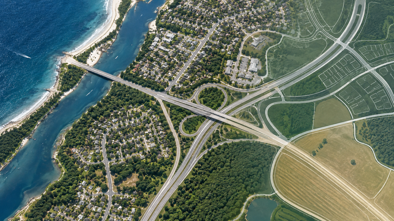
A road map is optimized for movement along named routes. An aerial view answers a different set of questions: Is the parking area behind the building? Does a river divide the property? Is the trailhead on the far side of the road? Which driveway appears to connect to the public street? These spatial relationships can explain why an address feels wrong when a driver arrives. Satellite-style context is especially useful for large destinations, campuses, parks, waterfronts, and rural approaches. For background, read Satellite View on Wikipedia when you need context beyond this planning guide.
Use the aerial layer to form a hypothesis, not to approve an action. A visible track may be private, a parking lot may be restricted, a footpath may be unmaintained, and a building may have changed since capture. The image can guide the questions you ask of the official venue, transportation agency, property manager, or current road signs. It is an orientation tool with a different viewpoint, not a legal access map.
How to inspect an aerial map before a journey
Begin with the road view and exact destination, then change to the available aerial or satellite layer. Keep the route visible if the service allows it and compare the selected pin with the physical property. Zoom out first to understand the larger road network, water crossings, neighborhoods, and regional approach. Zoom in gradually to study driveways, parking rows, building footprints, paths, and the place where the route enters the property. For broader route planning, visit MapQuest Driving Directions on the homepage after reviewing this MapQuest Satellite View guide.
Use a consistent set of questions: Where does the public road end? Which road appears to serve visitors? Is the lot separated by a median, railroad, creek, or fence? Which side of a campus contains the appointment building? Record only details that make the route more practical. If the image is too old or unclear to answer a question, mark it as unknown instead of inferring from color or shape.
Aerial context for airports, campuses, parks, and events
Airports are a common reason to use an aerial layer because terminals, parking garages, rental facilities, runways, and approach roads occupy a large area. The image can explain the broad layout, but current airport signs and terminal instructions control the trip. Campuses similarly contain internal roads, pedestrian paths, service areas, and multiple lots. An aerial preview can help a visitor understand orientation while the campus map identifies which gate or permit applies.
Parks, trailheads, waterfronts, and event venues require even more caution. A narrow road or blank area on an aerial image may be a seasonal access road, private land, floodplain, or maintenance area. Event-day traffic plans can close ordinary entrances and create shuttle zones. Use the image to choose what to verify: opening hours, parking, shuttle pickup, trail condition, public access, and emergency restrictions. Let current rules outrank the visual appearance of the property.
Road, terrain, and entrance clues
Aerial imagery can reveal road hierarchy and physical obstacles that are hard to see in a list of directions. A broad divided roadway, a tight bridge, a steep hillside, a service lane, and a long parking aisle all affect the final approach. It may also show shade, exposed lots, water, and the likely walking distance between parking and a building. These observations help set expectations and choose clothing, fuel, mobility support, or extra time.
Do not use color or apparent width as proof of a road’s condition or permission. A pale line may be gravel, a private lane, or a seasonal track. Trees can hide a curb, and a roof can obscure a pedestrian path. Cross-check important observations with the road map, street-level imagery, official instructions, and current local information. When sources disagree, slow down the plan and choose the access point that is clearly documented.
- Compare the aerial pin with the road address and property boundary.
- Trace public roads, visitor lots, sidewalks, water crossings, and internal paths.
- Treat unmapped tracks, blank lots, and visible shortcuts as unverified.
- Use current venue, airport, park, and traffic instructions for final access.
Imagery dates, privacy, and responsible use
Aerial images are snapshots. New buildings, demolished roads, changed parking patterns, storm damage, seasonal flooding, and construction may not appear. If a trip depends on a specific lot, bridge, trail, or entrance, verify it with a current source and leave time to adapt. A layer selector does not necessarily expose the capture date or guarantee frequent updates, so avoid presenting the image as real-time evidence.
Aerial detail can also expose private homes and property patterns. Use only what is needed for your route, avoid speculating about residents or activities, and do not share sensitive screenshots unnecessarily. The purpose of satellite view is to understand geography and reduce arrival confusion. Pair it with a standard route, current access rules, and respectful judgment.
How to use this MapQuest Satellite View planning guide
- Set a precise destination and inspect the standard road map first.
- Switch to the available aerial or satellite layer and compare the pin with the property.
- Zoom out for regional obstacles, then zoom in for roads, lots, buildings, and entrances.
- List the access questions the image cannot answer, such as permission or current closure status.
- Cross-check important observations with official venue, airport, park, or traffic information.
- Use the aerial view for orientation only and follow current signs and restrictions on arrival.
Questions about MapQuest Satellite View
What is MapQuest Satellite View useful for?
It can provide aerial context about property layout, roads, parking, terrain, water, and the relationship between a building and its approach. It should be paired with current road and access information.
Can I use a visible path or road shown in satellite imagery?
Not without verification. It may be private, seasonal, restricted, unmaintained, or outdated. Confirm public access and current conditions through the property owner or official local source.
Is satellite imagery live?
No. Aerial imagery is captured at a particular time and may not show current construction, closures, flooding, or new entrances. Treat it as a snapshot for orientation.
Should I use satellite view instead of a road map?
Use both for different questions. The road map supports route selection and legal navigation, while the aerial layer explains physical layout and possible arrival confusion.